For optimal and targeted mining exploration, supported by the most advanced technologies
We offer the studies listed below, specifically or globally, and according to your needs.
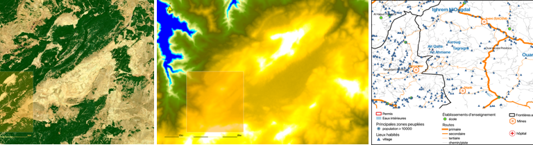
Geographical location, topography and climatic and hydric context of your mining permits
Based on various maps, the geographical location of the mining permits is detailed with all its connections to roads and urban and rural infrastructure. Satellite maps are used to describe the topography and water system of the watershed, and climatic data are used to describe the rainfall and temperatures where the mining permits are located.
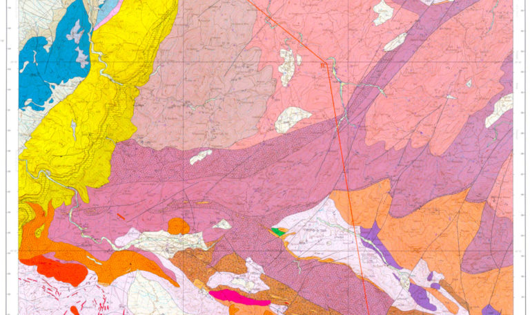
Geological and geological context of your mining permits
On the basis of geological maps of Morocco, your mining permits are placed in their global and regional geological context. Thus, a description of the geological, structural and geological formations in relation to the mining showings known by the geological services and in the literature is presented in order to orient your explorations. Indeed, the geological maps provide important information on the geological layers that outcrop, such as their lithologies, their ages (stratigraphy), their structural positions (tectonics) and the location of old and active mines, as well as potential mining showings.
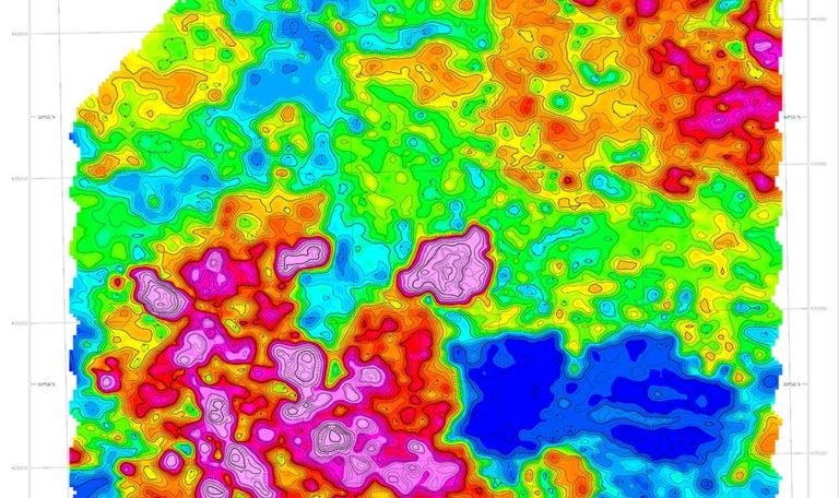
Description of geophysical anomalies
Geophysics is widely used as a direct deposit detection tool for mineral exploration. Indeed, the contrast between the specific physical properties of metal deposits and the rocky environment creates “anomalies” that can be detected at the surface of the ground, or by airborne. This is the case for contrasts in magnetic susceptibility, density, electrical conductivity and natural radioactivity (Thorium, Uranium and Potassium).
Mincape relates these geophysical anomalies to the geological formations in your mining permits and can provide the qualitative and quantitative elements (if data are available) of the regional or local geological model likely to contain useful mineralization, with economically exploitable concentrations.
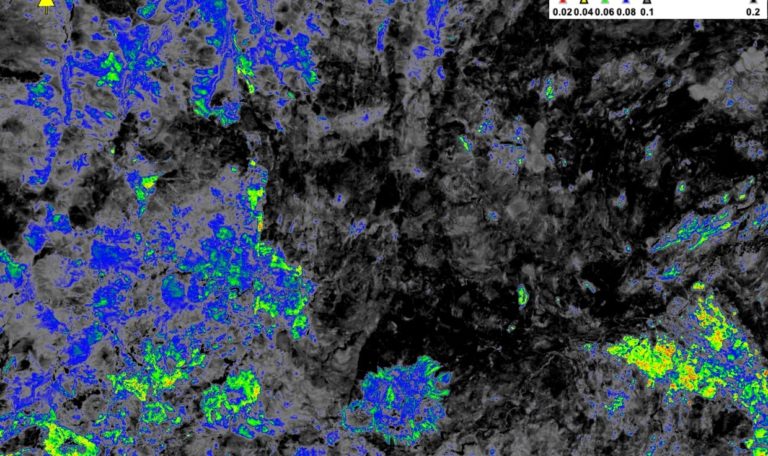
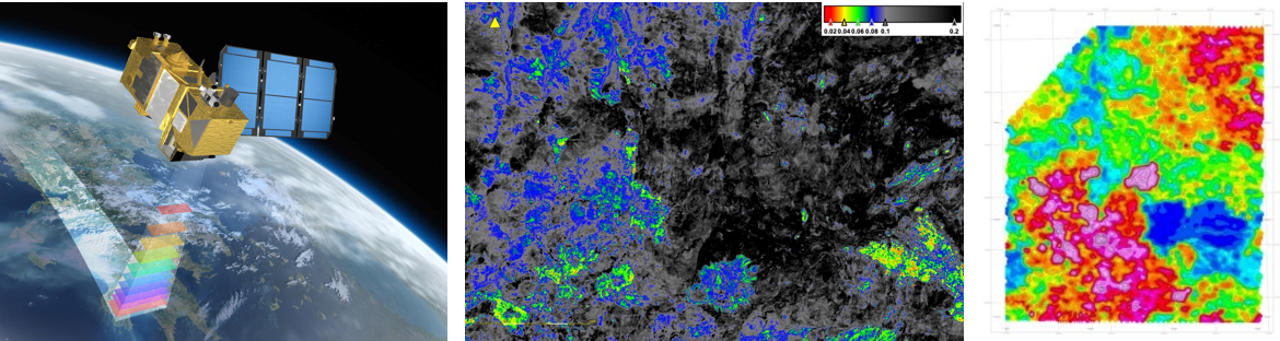
Remote sensing and digital processing of satellite images
Satellite observation of the Earth provides an integrated view of mining sites and their surroundings. Based on satellite images of large areas, Mincape can extract, by digital processing, geological and geological information in a global way in correlation with geophysical data. Thus, a mineral, chemical and hydrothermal alteration mapping is established allowing to locate outcrops (in research permits) and to orientate mining prospecting to help detect areas likely to contain interesting mineral concentrations. This approach leads to informed decisions regarding sampling areas in the field and would significantly minimize the economic risks incurred during exploration phases or campaigns.